5/13 – Akaka Falls, Laupahoehoe, and Waipi’o Valley

Monday was our travel day. We made our way from the east side of the island to Kona, on the west side of the island. Leaving our house in Hilo was a little bit sad. It was so nice to be there all together in such a cool place! Though Kona will be awesome too, I really loved getting up in the mornings and snorkeling or going for a swim, and in the evenings, it was fun to eat all together and then watch a movie. 

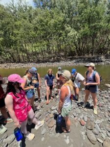
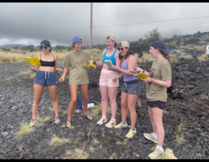
Throughout our travel, we made several fun stops. 

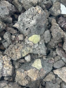
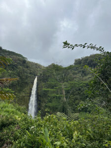
We stopped at Akaka Falls, and it was absolutely gorgeous. I can’t decide whether I liked seeing Rainbow Falls or Akaka Falls better. Becca told us that Akaka means “to split.” I suppose this makes sense considering the waterfall gradually splits the rock. It’s 442 ft deep to the gorge, and there’s this cool endemic fish that lives there. Legend says that when Akaka felt guilty about what he did while his wife was away and threw himself off the cliff; they then became the waterfall and rocks. We also got to hear from Katie about how the knickpoints of the waterfall work. They can be controlled tectonically, by lithology, and by climate. We learned about how the different parts of the river work together as an ecosystem. 

Akaka Falls
Akaka Falls

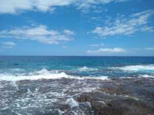
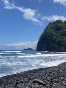
Our next stop was Laupahoehoe, which translates to “leaf of lava.” This was a place where many school children and teachers lost their lives to the 1946 tsunami. We heard from Jake about how water was moving at 490 miles per hour and spread to end up killing 159 people. There was no warning system, and that was one of the biggest reasons the tsunami caused so much harm. Now, there are systems in place so that people know to evacuate in case of a similar situation. We even got to see an example of one where we stopped; it looks a lot like a traffic light.

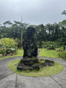
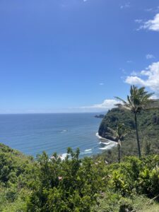
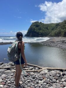
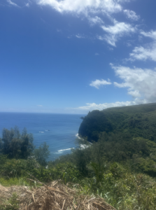
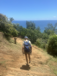
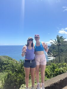
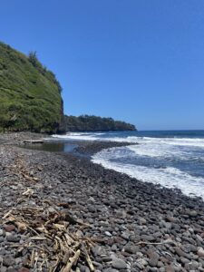
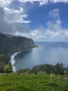
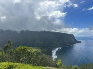
One of our final stops before reaching the hotel was Waipi’o Valley. I loved getting to stop at Waipi’o Valley. It is amazing to think about how a landslide could create such a beautiful place.

Waipi'o Valley
Waipi’o Valley

— HG Kornberg

5/12 – Lava Trees, Kalapana Beach, and Pohoiki

On Sunday, we got to see some lava trees! We learned that lava trees form because the large amount of water in trees makes the trees resist burning away for a longer period of time as the lava surrounds them. The lava trees we saw formed from the 1790 Kilauea eruption. They almost looked like statues! Mac told us about how the lava trees can tell us about the direction of the lava movement and about how the bark can be used to determine the age of the lava and when the eruption occurred. 

Lava Tree
Lava Tree
Lava Tree 2
Lava Tree 2


We also visited Kalapana beach, which formed in 1990 due to Kilauea. The 50 foot deep lava flows buried the original beach, and the sand is now black, formed from the basaltic lava rock. The beach is a symbol of regrowth, and local communities are continuing work to restore the area. 

Next, we went to Pohoiki, the island’s newest black sand beach. We got to learn about this location from Abby. Though it used to be a boat harbor, it is now covered with 5 year old lava flows from the 2018 eruption and sprinkled with warm springs heated by the eastern rift zone of Kilauea, some up to 98 degrees. I thought it was interesting that there are brine shrimp that live in the pools and about how one of the springs formed in the collapse of a lava tube. I didn’t get into any of the pools, but we saw lots of people swimming around when we visited. I stuck my hand in, and it was very warm.

— HG Kornberg

Corrupted Day 10 Post—Hawaii’s Leeward Side: Valley’s, Beaches, Run-off Warnings, and Xenoliths.

After driving around Hawai’i island, visiting Hawai’i Volcanoes National Park, exploring the Hamakua Coast, and much more, it was finally time for us to visit the busiest part of the island: Kona.  

We started our 10th day by driving through North Kona and into Kohala to visit the picturesque Pololu valley. Since Kohala is the oldest volcano on the island, there rocks in Poll are contain more alkaline and have sodium-rich feldspars.

Kaden Buss at Pololu Valley

The short, yet steep, hike was accompanied by the simultaneous refreshing yet revolting smells of the Pacific Ocean and rotten fish. Flash floods, just days before we visited, washed tens of thousands of tilapia downstream—which caused the rotting smell—- after large portions of the river dried up. 

Pololu Valley river after severe flooding.
After exerting our energy on the steep hike, we stopped for lunch, and
headed for the famous white sand beach Hapuna. But, there was a catch: For the first-time in my lifetime Hapuna was closed for something other than a high surf advisory. Instead, the Hawai’i Department of Health Clean Water Branch issued a Brown Water Advisory for the waters around North Kohala. This is because Heavy rainfall resulted in stormwater runoff into the ocean. The runoff could possibly contain overflowing cesspools, sewer, manholes, pesticides, animal fecal matter, dead animals, pathogens, and chemicals. 
Mac Malambri enjoying a scenic view at lunch in Kohala

Instead, as we have done the entire trip, our class pivoted. We were adaptable and decided to visit Hualalai Xenoliths. Just along State Highway 190—or as local’s call it, the ‘high road’—there is an impressive collection of Xenoliths with easy access via the road. The 1800-1801 Hualalai alkalic lava flows are famous for their Xenoliths.  These represent the mantle beneath Hawai’i and contains accumulations of olivine, pyroxene, and plagioclase that crystalized from pre-eruption magmas. 

Our class was able to appreciate the Xenolith’s by adding some ‘flare’. We seperated into two different groups: one group reenacting the formation of the Xenoliths and another group creating a catchy rap.

1800-1801 Hualalai Xenoliths.


After appreciating the Xenoliths and touching the mantle of the earth, the class was worn out for the day. Some of us grabbed Poke, others hung out around the pool, and everyone came together at the end of the night to have a nice, students dinner at the beachfront bar, Huggo’s on the Rocks. 

5/17: Saying Goodbye

Even as I’m writing this, my time in Hawaii is drawing to a close. Later today, I’ll be back on a plane, en route to the mainland U.S. The two weeks I’ve spent here have been an amazing experience, and instead of focusing on any one particular day or event, I wanted to use my fifth and final blog post to reflect on some of the highlights:

The Geology. I knew very little about the science of geology before taking this class, and being able to see plate tectonics, erosion, and volcanism in action has definitely increased my knowledge of this field. One of my favorite parts about geology is the combination of chaos and order that applies to any geologic formation. Take Chain of Craters Road, for instance. Each individual pit crater—such as Puhimau and Devil’s Throat—formed seemingly at random, with an abrupt drainage of lava that opened a sudden hole in the ground. At the same time, however, the craters are also part of a larger pattern, as shown by the fact that so many formed along a single path: Kilauea’s East Rift Zone. Because of this, geology serves as an important reminder that nothing happens without a reason.

A hand holding a shiny, vesicular rock
A rock. Yay geology!

The Culture. The Big Island has a unique culture that dates back centuries, to when Polynesians first colonized the island roughly a thousand years ago. I’ve had the chance to experience only a very small part of Hawaiian lifestyles and legends while I’ve been here, but everything I have seen has intrigued me. Especially interesting are stories about King Kamehameha, the king who united the Hawaiian islands under one leader. Kamehameha is treated with almost religious reverence by many, and the stories of his wise leadership and fierce battle skills are thrilling. In fact, he’s so important to native Hawaiians that there is an entire hotel in Kona named after him; I visited it today and got to see a large exhibit of forty paintings commemorating the king’s legacy.

A wooden tiki statue in front of a temple made of ferns and leaves
A culturally significant statue at Pu’uhonua O Honaunau

The Ocean. Obviously, a big part of any island is the ocean, which surrounds the island of Hawaii and even influences its volcanic activity. I had never seen the Pacific Ocean before coming here, and I hadn’t been to any ocean at all since elementary school. Every single day, I found myself staring off into the vast expanse of water; it’s still hard for me to comprehend just how far the empty horizon goes, considering that I’m used to being constantly surrounded by mountains. From watching the sun rise and set over the waters to body-surfing waves at the beach, I’ve loved able to connect with the primal force that is the ocean. It’s no wonder that native Hawaiians personified the sea as a deity—Kanaloa.

The ocean.
Ocean

The People. As corny as it sounds, what really made this experience worthwhile were the friends I made along the way. For one thing, I loved getting to meet local Hawaiians; I definitely better understand the spirit of aloha after seeing how friendly and welcoming the island’s residents were to our class. This was especially true of Clegg and Nicole, the amazing older couple from Leilani Estates who welcomed us into their home and made us pizza. Equally important, however, was building relationships with my fellow classmates. Kaden, Caroline, Grace, Margot, HG, Jake, Lucy, Mac, Becca, Abby, and Van are all great people. Whether we were snorkeling in the ocean at Hilo, soaking in the hot tub in Kona, or watching movies in the Cheeky Tiki, it was all a blast. And Professor Knapp and Katie were all excellent teachers who taught me a ton about a field I knew very little about.

Seven young adults standing in a line on the campus of Washington and Lee University
Flashback to before the trip

In closing, mahalo and aloha.

-Aiden

May 13th: Akaka Falls, Laupahoehoe

I’m writing this a few days late, but we had a very interesting day on Monday.

My class started the day trying a Hawaiian specialty (at least according to Kaden): spam. After everyone else had tried it and decided it wasn’t too bad, Mac refused to take a bite. The group then spent about 45 minutes trying to get Mac to try it. Unfortunately, we were unsuccessful, and Kaden was quite disappointed.

Our first official stop of the day was at Akaka Falls.

waterfall pouring over lush green landscape
Akaka Falls

We learned that the area around Akaka Falls was a 19th—20th-century sugar cane-growing region. The falls plummet down 442 feet, and the word Akaka means to split. An endemic fish only found in Hawaii, the oopu, spawns in the stream above the waterfall.

The legend around Akaka falls (briefly summarized) is as follows. There was a warrior chief named Akaka who sent his wife to Hilo one day to visit her parents. While she was gone, he went to visit another woman named Lehua. When his wife returned unexpectedly, Akaka was forced to flee Lehua’s house and return to his own home. When he arrived there, he began to feel ashamed. He left his house with his dog and arrived at a cliff, which he threw himself down, becoming the waterfall. His dog, being loyal, transformed into a rock at the top of Akaka’s waterfall. When his wife saw what had happened, she transformed into a rock to be with her husband. His lover, Lehua, was also despondent about what happened and cried herself into becoming a waterfall further down the coast. The end.

While at Akaka Falls, we also heard about rivers from Katie, who studies fluvial geomorphology. Here are some fun facts:

  1. Waterfalls are triggered by “knick points” which are big breaks in slope and elevation in a river, which creates a waterfall
  2. Knick points are controlled by one of three things:
    1. faulting motion, or pieces of land that slide off
    2. lithology, or the tendency of some rocks to erode more quickly than others
    3. climate, of the base level fluctuation of the river
  3. There are two primary kinds of rivers:
    1. meandering rivers, which are the snaking rivers we usually think of
    2. and braided streams, which have little sediment bars throughout that make the river look braided

The next primary stop of the day was Laupahoehoe Valley. Laupahoehoe lava created the ground of a village built in the valley, which was devastated by a tsunami in 1946. An earthquake in Alaska triggered a series of three tidal waves that hit the town in 1946, killing around 50 people, including 21 schoolchildren. The wave was 56 feet high and moved at 490 miles/hour. Find more information about the tsunami here at the link.

Here are two news stories posted at the memorial site:

Two news headlines about the tsunami
Remarkable story about a man who saved people during the tsuami
Remarkable story about a man who saved people during the tsunami


Polou Valley and the Xenolith rap by Lil Volcano

So I planned to write this blog today but we had a change of plans since our van couldn’t make it down the road to the beach because of some rocks and holes.

So now all reflect on Wednesday!!

We traveled forever to get to Pololu Valley. It was definitely worth the drive. It was such a beautiful view from the overlook. However, the hike was super steep and coming up was a struggle. All of at least got our cardio in! 

HG, Lucy, Abby, Van, and me hiking down the Pololu Valley

Polou Valley overlook of sea, palms, and cliffsMe at the bottom of the Pololu Valley

This valley is one of seven valleys of the kings. King Kamehameha has hid in this valley until of age for some would hunt him as a babe. These beautiful valleys were formed through erosion. Located on Kohala, there are more alkalotic material. We can see lighter rocks such as sodium feldspar. The sand was also super fine due to erosion and weathering. We even got to see sand dunes. These dunes are where some Hawaiian bones are buried. 

The class studying rocks and sand in Polou Valley

After Pololū Valley and eating lunch we tried to go to a beach on the way back but it was closed due to debris in the water. So we went straight to see some xenoliths!

A xenolith is a rock trapped within another rock. These specific ones are large olivine that were trapped in magma from 1800 lava flows. 

Lil Volcano (or band) featuring Caroline, Grace, Margot, HG, and I made an amazing rap about the Hawaiian volcanoes for our recap assignment here. Below are the lyrics…. Drop the beat.


Geology rocks,

So take of your socks

Head to the sand 

For the smallest rocks in the land

You may see green

You may see black

Either way, you’ll wanna come back


Green is olivine 

Black is lava stream

Only one volcano?

Okay no

Kilauea 

Mauna Loa 

Erupting their basalt ah

But Kohala is the mama

North of Mauna Kea

But wait! There more

Hualalai 

Is also on the tour


But don’t get to close

Or Pele will make you burnt toast

Written lyrics of or rap

Here’s a picture of doing it:)

Lil Volcano (our band) rapping

-Becca Goldman


Pololū Valley

As the northernmost of the seven valleys on the north shore, the views of Pololū Valley sure do not disappoint. These valleys were all created from erosion and off-shore landslides of Kohala, the oldest volcano on the island. It is estimated to be about 1 million years old and stopped erupting about 120,000 years ago. It is not likely to erupt again; however, it might when going through the rejuvenation stage.

pololu valley

This valley also has much cultural significance as it has been the home of ancient Hawaiians since around 300 AD. It also hid King Kamehameha when he was a child so that he would not be killed because of the prophecy that stated he would unite all the islands. This valley got a lot of rain and was the perfect place to grow Taro, a significant food source.

hike down to bottom of pololu valley

It was a short but steep hike down to the bottom, where we were met with black sand and the smell of rotting fish. The previous night, these fish had been washed down to the coast in flash floods. In examining the rocks, we found that they differed from those we had constantly been seeing: black, vesicular basalts. These rocks were lighter in color and had dots of white in them. This difference is due to the volcano’s age and how later-stage volcanos create lighter, more alkaline rocks.

Me and grace standing on the ledge of the pololu valley

Hope for Second Chances at The Place of Refuge

We traveled to the Place of Refuge, one of the Hawaiian National Parks called the Puʻuhonua o Hōnaunau. The park is on the coast with a beautiful beach and coral reef. This location has huge historical significance and value for Hawaiians.

The small village was once a place of sanctuary, forgiveness and freedom for Hawaiins running from war or breaking kapu. Kapu were the laws that governed all living things in Hawaii, decided by chiefs, and had to do with everything from when to plant to where to swim in the ocean. These laws were more strict for women who were restricted from things we would see as small, for example, women were not allowed to eat banannas. If a someone broke kapu the punishment was death unless they could reach one of these sancuatry locations. There were a few of these in each district, and if a kapu breaker made it they would beg for forgivness from a priest and be given the chance to heal. However they were not allowed to leave unless their healing was deemed over which could be anywhere from months to their whole life. The process is not as easy as it sounds though, as there were people whose sole job it is to hunt for kapu breakers and kill them before they reached saftey.

temple and beach of the place of refuge

These Puʻuhonua were the most scared places in Hawaii and had temples where chieOf bones were barried. They also had ki’i sculptures, known to us as tiki, that were made out of wood and represnted the Hawaiian Gods. One of the main temples is loacted right on the beach infront of the ‘door’ to the Puʻuhonua, which was the only place where one could enter the sacred space. Now no one is allowed to swim on that beach to honor and protect its history.

hawaiian ik'i

We got to hear and learn from one of the park rangers about the location and were able to experince an authenitic Hawaiian chant!

Powerful Pololu Valley!

Yesterday we started with a nice sweat as we descended and climbed up the steep cliffs to see the Pololu Valley! This Valley is also on the coast that the Waipio Valley is on, therefore was also formed from Kohala land slides, erosion from rainwater, wind, and other factors. There are sand dunes that are sacred to the Hawaiians that were formed from winds and the tsunami of 1946! King Kamehameha also hid in this valley when growing up to not be killed and fulfill his duty as the future ruler of the Hawaiian Islands. We found alot of rocks that were a lighter color and had Calcium rich Feldspar bits in the rock which is alot different than the basalt with Olivine we have seen alot of.

Pololu valley at the bottom

pololu valley from the bottom

Margo and me standing on the ledge of the pololu valley

This hike is short but steep!!! Around 500 feet in about 0.5 miles! Definitely got my heart rate up and my legs pumping! There were also so many Tilapias in the river and on the shores from the flash flood earlier in the week, which made for quite a disgusting smell. The views made up for the smell though and I am grateful for the opportunity to hike down to the Valley!

Margo and I before the hike
Margot and me before the hike!!
Caroline and I
Caroline and me after the hike!!

Wonderful Waipio Valley!

On Monday, we visited the absolutely breathtaking Waipi’o valley! Waipi’o means curving water 🌊 This valley formed from the sliding of Kohala and the erosion of the cliffs from water.

Waipio Valley

This valley is located on the Hāmākua Coast, and serves as an important place physically, and religiously. As the childhood home of King Kamehameha, this valley is important. Kamehameha the Great was declared the future ruler of the Hawaiian Islands by the war god, Kukailimoku. This made the Kings from Maui and Kauai upset and led to destruction of temples and a war in which Kamehameha came out victorious.

King Kamehameha Statue

It is called “The Valley of the Kings,” and rulers’ bones are buried in the caves along the cliff sides.

This valley once housed thousands of Native Hawaiians, but now around 100 Hawaiians live amongst the waterfalls. This valley used to be home to farming and fishing villages, fruit orchards, and lots of animals. A tsunami in 1946 destroyed the town, but left roaming horses in the valley. Sadly, we didnt get to see any wild horses, but the valley itself was more than satisfactory!

IMG_1142