Day 11: The departure

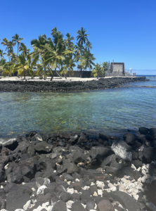
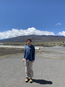
The final day of our trip, we woke up for a relaxing morning. I went paddle boarding with Kaden. It was beautiful to watch the sun crest over Hualalai from the water. After paddle boarding, we went back to the hotel and joined the rest of the group in getting breakfast from the grocery store. We all got this Hawaiian delicacy called malasada. It was like a jelly donut. A lot of people went to the beach, but I chose to pack and then walk around downtown Kona. Despite going to every store and the farmers market, I quickly ran out of things to explore. Eventually, I made my way to the King Kamehameha Hotel’s exhibit. I finished the first half before it was time to go to lunch. We ate lunch at the Big Kahuna. I reminds me a lot of Provision Company in Holden Beach, being a raised, open air restaurant that overlooks to ocean. After lunch, I continued exploring the King Kamehameha and finished the second half of the exhibit. I then joined Jake and Aiden for Foosball and Shuffleboard in a random hotel room we found. Then, it was finally time to go. We all loaded up and jumped in the van. My van picked up snacks from the grocery store which took longer than we expected, so Katie had to put sports mode on to get us to the rental car place in time. They shuttled us to the airport. We got through security, but our plane kept getting delayed. It was cool to watch the sunset over the lava fields surrounding the airport, though. 

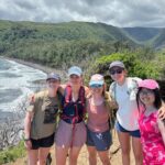
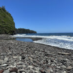
I was blown away by my experience in Hawaii. I expected the black sand beaches and beautiful cliffs. I did not understand the immensity of 14,000 ft of mountain. I did not imagine how striking the Waipi’o valley is. The green sand beach with its towering waves were something between frightening and beautiful. The most amazing thing is that one island—small enough for my trip to circumnavigate in two days of driving—can have such bountiful geologic diversity. I also have a new appreciation for tropical places, now that I know they can be more than just a bunch of beaches. Honestly, the white sand beaches were by far the least impressive part of the island. It was the inside that makes Hawaii incredible.

Day 10: The Beach

By Mac Malambri

I woke up today and decided to check out the beach. Some of my friends were going paddle boarding. I just walked around Kona. It is cool to see before the world awakens. Unfortunately, Kona has an unbelievable homelessness problem. Before 9 AM, every semi-flat surface is covered by a destitute man or woman. This one guy today showed some beauty in the face of poverty. He and his dog were asleep on the sea wall. While they are in such desperation, there is beauty in the fact that they still care for one another. I hope that they can someday find a better life.

After breakfast, we headed to a beach that is South of Kona. We turned off the highway onto this rough road. Our vans made it impressively far, but eventually we got to a point that they were not going to cross. Unlike a certain small SUV, they cannot drive over gradients and surfaces far beyond what they were designed to do. After turning back, we preceeded to another popular beach. It was so hot! Trying to avoid sunburn, I hid underneath a tree I found while eating lunch. I briefly emerged from this tree and sent swimming—after applying sunscreen this time, but did not last too long. I quickly retreated to my tree. From my hiding spot, I watched a pack of goats and some moonguese. Moonguese aren’t that interesting; they’re like fast squirrels. Goats are amazing. They gradually move across a landscape getting their food. When treatened by a potential predator—like me—the largest bravely goes forward to push it away, while the little baby goats run to another adult. They are such elegant creatures. 

We finished early this day and went back to the hotel. Us students enjoyed the hot tub and reflected on our journey. We got dinner back at Foster’s Kitchen—the first restaurant we went to. We headed to bed early, in preparation for what is sure to be a long and strenuous 20  hours of travel.

Day 9: Pololu

By Mac Malambri

I woke up this morning to a nice morning run. Honestly, my sunburn did not hurt as much as I was expecting and I wanted to prove to myself and everyone else that I was fine. I ran down towards the resort in North Kona, but after only about a quarter of a mile, the road turns towards the highway, so I decided to turn around. I ran south for a while. I saw the sun gradually rise over the bay and reveal a cruise ship: the Pride of America. I believe that it is the only cruise ship registered in the US and thus able to dock directly at two US ports without stopping. That gives it the unique ability to operate in Hawaii. According to Kaden, it also means that everything will be crowded with today with cruise ship people.

After my run, I got my continental breakfast and got ready for the day. I strategically wore a white Columbia fishing shirt, so I could get great sun protection without overheating. We piled in the vans and departed for Pololu valley. Pololu valley is the north most valley of the King. Like Waipi’o, it is formed by the erosion of river valleys and gives way to a beautiful landscape. We drove north along the coast. Out of the endless sea, gradually emerged a faint outline. At first, it looked like an oddly shaped cloud that was just over the water. Eventually, one could recognize it as the island Maui. It was crazy to see another island for the first time.

Once we arrived at Pololu, we were greeted with a warning that there are no bathrooms. Furthermore, being sacred ground to native Hawaiians, we must leave the premises to releve ourselves. Accordingly, we drove 2 miles to a nearby state park to prepare for our journey. Pololu is protected by a private organizations that informs visitors of the significance of the location, the rules for respecting it, and safety information. It is actually really cool. The organization was created by a local woman who just cared about her home and keeping people safe. A volunteer told us that because of recent flooding, all the fish are dying. The bacterial growth this causes prevented us from getting in the water. Also, it is very steep and easy to get injured on the hike.

We then started down the hike. Jake and I took it easy: getting photos and appreciating the view. I can describe it as a narrow valley that gives way to brilliant torquoise water with two small islands that perfect the vista like a cherry perfects an ice-cream sunday. Those islands are actually formed by waves burrating the coast, until they are fully separated from the mainland. 

Island Island Island

At the bottom, we enjoyed a view of the seashore and the smell of rotting fish, Kaden was also sad because that flood destroyed the beautiful marsh that once existed there. Nevertheless, across a small stream, one could see the ancient burial grounds of native Hawaiian chiefs. It was in this valley that a young King Kamehmaeha hid from the rival Hawaiians who sought to kill him so he could not fulfill his profacized uniting of all the islands.

Along the shore, we learned about the process of creating the beach. Instead of basalts—like on the previous black sand beaches, or coral like on the white sand beaches—these beaches consist of minerals like Hawaiitate that are created in late stage eruptions.

We finally preceded up the trail. I had a lot of questions about my home state’s geology, so I walked slowly with Professor Knapp. That was probably smart, because it meant I got to enjoy the view, learn a lot of my home, and did not wear myself out too early. At the top, a member of our group became a victim of heat exhaustion. The wonderful people who cared for Pololu, helped this person back to health. We then retuned to the state park for lunch. There, we ate and then conducted a review of the trip so far. We were even graced by the presence of a local elementary school, practicing traditional Hawaiian customs. We then returned to the hotel. This night, we headed to another local place that Kaden knew. After that, we went to bed and prepared for the next day.


Day 8: The Clear Blue Waters

By Mac Malambri

This morning we awoke early to go to a special beach Kaden told us about. We are now back on his side of the island, so he has unique knowledge of cool places to visit. Unfortunately, only Katie could leave in her van, so only 7 of the 12 students got to go. We drove about 25 minutes to this beach South of Kona. It was picturesque. This is the white sand Hawaiian paradise, cut out of a cliff with palm trees one imagines when they think of the island. There were small wooden structures alongside it. The little cove was flanked on both sides by rocky cliffs. It was really cool. Some people got out there on snorkels, but I got one of the two paddleboards. Even though it was too rough for me too last more than 20 seconds standing up, it was so cool to kneel around the cove. The beauty was immense. I especially love the beach right after sunrise and soon after sunset, so it was great. 

Eventually, we all got on the two paddleboards and just hung out and talked for about an hour, enjoying the natural beauty. This is probably the best time I’ve had just hanging out on a beach in years.

Kids on paddle boards

Unfortunately, since Hawaii is closer to the equator than South Carolina, I failed to anticipate the borage of UV that I would face at 9 AM. Being on a paddleboard without sunscreen, I got a pretty bad sunburn. It is alright, though.

We then departed our tropical oasis to mee the rest of the group at a state park. Pu’uhonua O Honaunau was a place of refugee in ancient Hawaii. Hawaii was once governed by an elaborate system of rules and costumes called Kapu. Kapu prohibited making eye-contact with a chief, fishing in overfished ponds, and women from eating the sacred fruit of bananas. Breaking kapu was punished by death. The only way to avoid this fate was to make the perilous solo journey to a Pu’uhonua, or place of refugee. This particular one was also a popular meeting spot of chiefs.

Pu’uhonua O Honaunau is a beautiful site. My professor remarked that it would not be a bad place to be exiled. It is a peninsula that sticks out into a small bay. Nevertheless, the palm trees provide little shade. On this sunny day, the endless torment of the sun was almost unbearable. I rushed through the site and hid in the amphitheater well before the start of the presentation. The presentation was by a native Hawaiian park ranger about this spot. She actually grew up just miles from this landmark. She gave us a review of the site’s significance and Hawaiian history more broadly. We also figured out that she was Kaden’s kindergarten teacher. 

temple and beach of the place of refuge hawaiian ik'i Statues

We then proceeded to eat lunch. We ate just outside of the park at a couple of picnic tables. It was a good view, but once again, so hot. We then went to the nearby snorkeling spot. I tried my best to do it, but I just do not enjoy snorkeling. I did see some really cool fish. They are amazingly large for such a shallow reef; however, I spent most of my time in the warm, shallow tidal pools. After snorkeling, we headed back to the hotel. All of us students went to the hot tub after and prepared for dinner. After dinner, I went to this shaved ice place.


Day 7: The Road to Kona

By Mac Malambri

Today, we departed our rental house for the last time. As soon as you cross the first river, the environment totally changes. The long and even lava flows give way to river valleys. The river valleys form as erotional properties, principly flowing water, weathering away weaker rocks and forming these valleys. Initially, they are narrow like the one with Rainbow falls; however, as one proceeds, they form lush and wide river valleys, such as the Waipi’o Valley and Pololu valley. 

Waipi'o valley

As we left Hilo, the environment became extremely lush. We drove through a botanical garden. It reminded me of the rainforests in Costa Rica. There is dense greenery on all sides and little streams gracefully cut through the jungle.

Our first stop was the Laupahoehoe memorial. Hawaii is vulnerable to numerous hazards. Among these are the dreaded tsunamis. Tsunamis form an earthquake or landslide displaces a large amount of water. This water begins to oscillate as waves. Because of the depth of the Pacific, the waves can have huge amplitudes—and thus carry huge amounts of energy—yet still be basically undetectable from above. Tsunamis become concerning when the seafloor rapidly rises as it approaches land. This causes the amplitude of the wave to become noticeably above the seafloor and eventually create huge waves. The only warning before the Pacific Warning System was a rapid high or low tide minutes before the tsunami hits. Then, you would see a huge wave at horizon. In 1946, there was a village in Laupahoehoe. That village had a school near the shore. Out of nowhere, it was hit with a 55 ft wave that liked 159 people across the Hawaiian coast. The school children died. The local pastor raised money for a memorial. Laupahoehoe is beautiful but the tragedy dominates the area. As a silver lining, it caused the development of the Pacific Tsunami Warning System. First operating in 1948, it consisted of advanced equipment that detects earthquakes and small changes in water level throughout the Pacific Ocean to identify tsunamis before they occur. On island, you can see the horns on poles scattered everywhere. They remind me of the sirens in the TV show lost.

After Laupahoehoe, we headed to the Waipi’o valley. The Waipi’o valley overlook shows where this valley meets the ocean. It is immensely beautiful. Photos do not do it justice. Unfortunately, due to property disputes, only residents can go into the valley right now. Even seeing it from above was amazing, though.

Finally, we continued across the island to our hotel in Kona. That night we unpacked and went to dinner. Everyone was ready to hit the bed since we finally were back in air conditioning and sleeping in beds, not on the floor.


Day 6: Kilauea’s Eruption

By Mac Malambri

Like Professor Knapp predicted, today was cloudy. We awoke and no one wanted to leave the house. Every other day, we’ve had early morning swims or kayaking. This morning, breakfast was over TV. We all ran from the house to the vans in preparation for our journey today. 

We first headed to the lava trees. This was my area to introduce. The lava trees were created by the 1790 eruption of Kilauea. They occur when lava surrounds trees. Sometimes, the moisture evaporates, cooling the trees and preventing them from burning before the lava solidifies. This creates vertical pillars of rock called lava trees. Alternatively, lava can also cause the trees to burn. After the lava solidifies, this leaves an imprint of the bark on rock that geologists can use to learn about the flora before the eruption and also date the eruption. The lava trees were cool to see. 

Lava tree

Next, we went to visit this couple that Professor Knapp met at an art gallery they help run in downtown Hilo. They offered to make pizzas and tell us about their experience during the eruption. We drove to their house. When we got there, they told us to walk down the road in their neighborhood towards fissure 8. Fissure 8 was the fissure that caused the most destruction during the 2018 eruption of Kilauea. It was crazy to see this normal neighborhood street suddenly give way to pahoehoe lava. You could even see the iron fence piercing out of the lava at places. People had put tents and even a greenhouse on their old property that was covered in lava. 

Dead end

We then went to visit the couple. They had made these amazing pizzas with all sorts of vegetables on it. They were so good. Their house was filled with beautiful artwork as they are both artists. The husband is a Vietnam veteran who became a truck driver. The wife worked as a physician’s assistant in California. They moved to Hawaii about ten years ago. In 2018, the eruption began. They were evacuated within 24 hours of geologists identifying the eruption. They temporarily moved to Kona during the eruption. They said that it was scary to not know what condition their house was in. It took 18 months to move them back into their home. 

We finally returned to the house and enjoyed pizza for dinner as prepared to leave.


Day 4: Green Sand Beach

By Mac Malambri

I woke up and decided to further explore our part of Hilo. I ran around the area. To the south, there is a park with lots of muddy holes. It has tall trees directly bordering the seashore. Behind the house, there is a narrow road that appears to be surrounded by a jungle. To the north, there is this beach park that is larger than the one across from our house. It is beautiful.

After running, showering, and eating breakfast, I joined the group in departing around 9:30 for the Green Sand Beaches at the south of the island. It was a very long drive that I had the privilege of having aux for. We crossed Kiluaea in Volcanos National Park and decended towards South Point. We stopped for gas and snacks in a little town. It was amazing how expensive regular items are in Hawaii. 12 packs of toilet paper was $35. We took a left off of HI-11 onto this narrow county road that looks like it could be in be in rural Rockbridge county. We broke off the road to the South Point near the windmills. We headed to the green sand beach at Papakolea. Once we parked, we began our hike. It was incredibly dusty. Every step released a cloud of red dust. We hiked alongside the seashore. There were a multitude of rocks, some pebbles, others as big as large flower pots. Sand filled the gaps, making miniature beaches. We hiked through sandy paths around the width of a truck bed that scared the endless grass field like a river scars a delta. After 2.8 miles, we reached a small cove in front of a huge boulder. Within this cove, we find the famed green sand beach.

Green Sand Beach

We descended into the cove and finished our lunches. Professor Knapp gave us a brief introduction to our assignment. We needed to use our handheld lenses to evaluate the minerals in the various layers of rocks in the cove and create a map of the layers. Ultimately, we sought to evaluate the source of the olivine that makes the sand green. The sand where we sat is the greenest, being approximately one third of all three minerals: olivine, calcite, and peroxene. As you approached the water, peroxene increases as the other two decline in content. Likewise as you went above the green sand onto the rocks. Thus, there was rather narrow layer with higher olivine content that was currently on the beach. Since it was lower in the water, the water did not bring in the olivine and it must have been created by weathering basalts made from lava flows. Thus, as the beach continues to be weathered and less olivine is available, the beach will decline. 

We also swam a little bit in the cove. The waves were so large. Once the waves brought out the water, the water towered over me. Some locals—who lived on the border of bold and insane—kept jumping into the breaking waves. The waves broke in a spot that was dry when the water pulled out. They were literally seconds from death at every jump. After swimming, we returned through the dirt delta to our cars. We also figured out that Van lost her Apple Watch. We drove back and stopped at the gas station we came through before. Unbelievably, they had Van’s watch. Finally, we stopped at Thai restaurant and enjoyed Sherly Temples together.

Grass People

Day 5: Mauna Kea and Mauna Loa

By Mac Malambri

I woke up this morning to text about the most incredible view of Mauna Kea. Mauna Kea, being above the cloud line, is almost never visible. It was incredibly beautiful to see a 14,000 ft mountain from the sea to the peak. You could even make out the little white observatories dotting the top of the mountain.  It was cool to explore a couple more beach parks. I went for a short bike ride around the area. It was weird to be riding on flat land for the first time since January. 

We first departed for the farmers market. It was cool to spend a couple hours in downtown Hilo. The venders had all sorts of different items. There were all sorts of fruits in the farmers market. I especially loved the pineapple and mango. The fruit was so cheap too. The nearby tourists markets were not quite as cool. They had a lot of cheap items, but nothing super exciting.

Mango

Kaden told us about this awesome Hawaiian barbaque restaurant he loves. We made the trek from the farmers market to enjoy it; it wasn’t actually that long, but felt like it was. Half the group showing up at this small restaurant at once seemed to overwhelm the restaurant and it took a while. We then enjoyed lunch in Queen Liliuokalani’s Japanese Garden. It is the largest Japanese Garden outside of Japan. 

Finally, we began our ascent of the Saddle Road. We drove through fog and rain up 6000 ft.  The Saddle was suprisingly clear considering the surrounding conditions. We first went to a hill that was spared by the lava flows of Mauna Loa. It is considered sacred by native Hawaiians and is geologically interesting since the flora was isolated by the lava fields. Surprisingly, non-Hawaiians are allowed to explore these places; however, there are specific rules one must follow in them. The rules are reasonable and seem like common sense for respect. For instance, you shouldn’t photograph people as they pray without their consent. There was actually no one else there, though. It was an island of lush growth in a sea of rock and small grasses. From this island, we had a great view of Mauna Kea and Mauna Loa. Professor Knapp said that normally you can hardly see your hand on the saddle, so seeing both volcanos was extremely lucky. From there, we went to a park for restrooms and relaxation. It was cool to have a break in such a beautiful place. 

Some may wonder why we did not accend Mauna Kea. Mauna Kea is the world’s largest mountain, beginning on the Pacific Ocean crust and reaching a height of 14,000 ft above sea level. It is home to vital observatories. Being in the center of the desolate Pacific Ocean, above the cloud layer, and on an island that has a strict light curfew of 9:00 PM, the observatories have a clearer view than anywhere else on earth. However, being above the clouds, native Hawaiians view it as the most sacred space—the spot where the earth meets the sky. It has become home to protestors—or protectors, as they call themselves—who oppose the use of Mauna Kea for Westerners. Between this and the fact that ascending 14,000 ft in a couple hours makes you very sick, Professor Knapp decided to stop making the journey to the top of Mauna Kea.

In the past, Professor Knapp replaced the journey up Mauna Kea with a visit to the climate monitoring facility on Mauna Loa. However, Mauna Loa erupted in late 2022. This cut off the observatory road and the observatories were decommissioned. Professor Knapp had the idea that we drive up the old Mauna Loa road to where it was cut off by the lava flows. Everyone assumed it would have been closed, but we tried anyway. Shockingly, it was still open. The lava field along the road is like a gray desert between two towering giants. One that becomes shorter as you drive, while another becomes even more daunting. It looks so desolate that NASA used to study how people would respond to life in isolation on the moon or Mars in the lava field surrounding Mauna Loa. After like 20 minutes of driving, we reached the end of the road. There a lava flow covered the road. Walking over it felt like walking on the moon. Mauna Loa looked like a mere hill from 9,000 ft. Mauna Kea was even more beautiful and immense. Driving back down the road was bittersweet. A part of me wasn’t ready to leave. A part of me just wanted to see the stars rise over the mountains. Yet, the ever approaching wall of fog—that’s not an exaggeration—forced us to retreat. 

Jake points at Mac using a handlense Mauna Kea Maunea Kea Mauna Kea Flag

Driving through the clouds was crazy. In one minute, we went from a perfectly clear view of the blue sky to not being able to see more than 15 ft away. We returned to our house and enjoyed left overs before going to bed. This was one of the most beautiful days of my life.


5/15 – Pololu Valley

We started Wednesday off with our Pololu Valley hike. It was hot, and the terrain was steep, but this was probably one of my favorites things we saw on our trip. We were on the oldest volcano, Kohala, which is in later stage volcanism. As a result, there is much more growth and vegetation in the area, and the sand is much more fine than down in the south part of the island. This is because there has been more time for plants to grow and for rocks and sand to be weathered down by wind, water, etc. The sand was black with some white crystals and contained sodium rich feldspar and more alkaline basalt. While there is more flat, sandy ground at the bottom, there are sand dunes all around that have been formed over time by wind. It’s crazy to think that King Kamehameha hid in these very same forests years ago!

Another component of this location I found interesting was the large number of fish waiting in the bay for some more rain!

Fish at Pololu Valley

— HG Kornberg

5/14 – Pu’uhonua O Honaunau

After a fun outing in the morning to go swimming, we visited Pu’uhonua O Honaunau. Hearing the stories about this place from Kaden was really fascinating. Pu’uhonua O Honaunau was the place of refuge for people who broke kapu, the system of Hawaiian laws. I think it is interesting that Hawaiians respected the power of this sacred place so much and did not mess with any rule breakers that could make it here. It was also interesting to hear some kapu examples; apparently, women were not allowed to eat bananas! 

We attended a presentation, where we learned an acronym to help us remember some key components about this place. It spells out SACRED, as below.

  • Shelter and safety
  • Ancient people and philosophy
  • Ceremony
  • Rituals and rites
  • Elemental forces
  • Divine energy

After this, we had a great day of snorkeling!!!

— HG Kornberg