Lava Trees, Fissure 8, & Pohoikis!

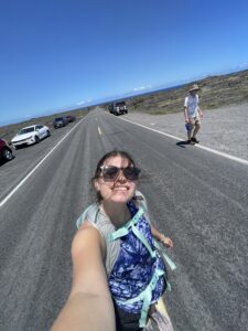
I started off my day this morning at 7:00AM, and went to church at 8! Church was great to attend this morning, especially in Hawaii and on Mothers Day. It was really interesting to see the Hawaiian culture to be even in religious areas! Some of the service was in Hawaiian which was super interesting.
I went back and called my parents, and wished my Mom a happy Mothers Day! Everyone. If you are reading this on Mothers Day, stop right now and wish a Mom in your life a happy day!

Cute "just smile" sign this morning
Cute “just smile” sign this morning


A church
Church!

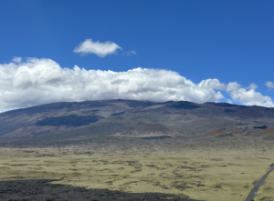
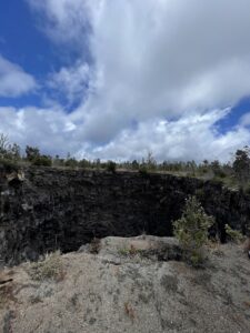
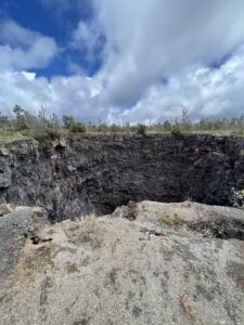
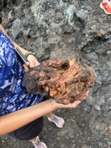
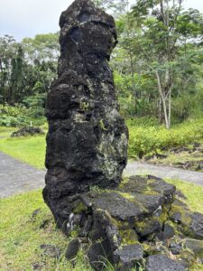
After this, we loaded up the vans to go to visit the lava trees. The lava trees and the lava tree molds were formed after the 1790 Kilauea eruption. The trees are filled with lots of water. When lava surrounds them, the water evaporates, and as the tree cools, it insulates itself from the lava, encasing it and forming a lava tree. To form a lava tree mold, which is in the ground, the tree actually catches fire and fully burns. Sometimes, in lava tree molds, the texture of the bark can be seen! The lava trees and the lava tree molds have a large geological importance, as they can show the direction of the lava flow, the date of the eruption, and more important information!

lava tree
Lava Tree
lava tree mold
Lava tree mold

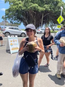
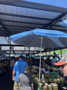
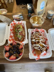
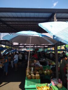
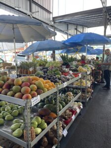
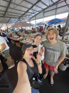
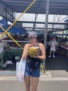
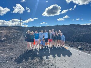
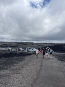
After this, we visited a local couple who lives by fissure 8. Yesterday at the farmers market, Professor Knapp was looking at an art gallery and met one of the artists who lives by that fissure and she invited us to see the fissure and her house, and to have a pizza party with them!
They had a beautiful house, full of Nicole’s artwork.
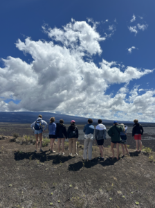
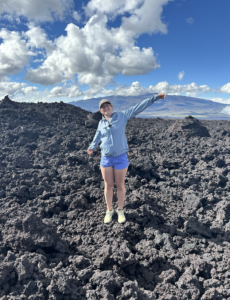
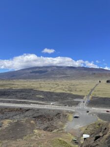
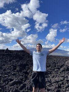
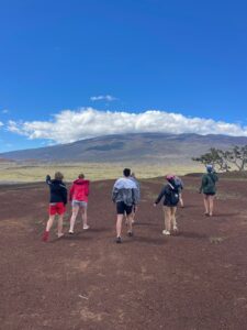
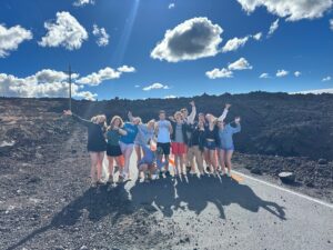
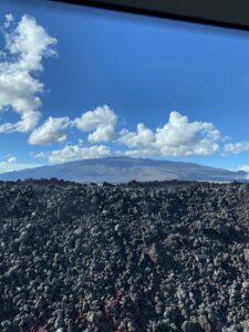
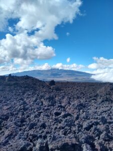
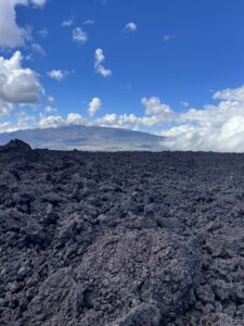
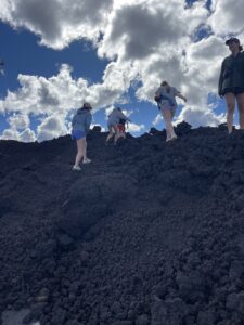
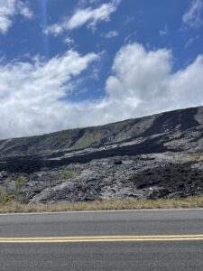
Before the LOVELY and DELICIOUS pizza party, we went to the edge of the lava by the cinder cone created by the 2018 kilauea eruption. 700 homes were taken and destroyed by this eruption, but there were 0 deaths. Fissure 8 was the most destructive out of all of the fissures. Unfortunately, there is no lava insurance for Hawaii, so the people who lost their homes, lost everything. At the edge of the lava flow, we saw “kapu” etched into the lava that bordered a burnt fence on the outer edge of a burnt driveway. “Kapu” translates to “no trespassing” or “forbidden”. We did not go further into this lava flow, as it would be quite inappropriate considering underneath it lay people’s entire homes and belongings. Sadly, the homeowners now own parts of that cinder cone.

Lava flows cutting off a road, and covering houses
Kapu written in rock at the edge of a ruined driveway

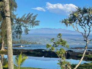
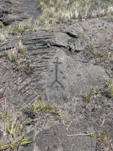
After listening to the eruption stories from the kind couple that welcomed us, we said our goodbyes and headed toward Kaimu, which is a beach by Kalpana. Kaimu literally means gathering at the sea. It was a large lava flow that was formed in 1990 from the Kilauea lava flows. It buried most of the original black sand beach. The black of the sand is from the volcanic basalts. Today, we did not see any black sand since the tide was in, but usually you can see it. The place is a symbol of regrowth and return with the immense vegetation regrowth after the lava flows. The surrounding community cleared up these lava flows and labeled some plants for non-natives, after some groups graffitied and took over the lava rocks.

Walkway toward the Kaimu beach
Cultural paintings on the lava rocks by the beach

We then headed to Isaac Harbor and the pohoiki’s that surround it. Isaac Harbor was the primary working boat harbor to its surrounding community, and was taken over by lava in 2018. The lava entering the water creates some glassy basalt and laze (gaseous HCl). This glassy basalt now created the largest and most new black sand beach in Hawaii.

The old harbor, with a hot spring in the background

Here is some background information that I lectured on before I dive into Puna Hot Springs…

Puna is known to be Pele’s workshop, where the volcano goddess continually creates and recreates land. Puna is the area from kilauea’s summit east to the sea, and is where the hot springs are!

Now…
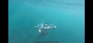
Pohoiki in Hawaiian literally means small hole, fitting due to the size of the spring. Most of the hot springs existed before the 2018 eruption, which created the biggest black sand beach on the island as I’ve previously mentioned. The lava flow from this eruption also formed surrounding springs that are larger but with less consistent temperatures.

The pool was formed in a collapsed lava tube. The groundwater is heated by volcanic activity in the eastern rift zone of the Kilauea volcano. The pools are filled with rainwater that is heated to around 100 degrees and as it flows above the lava underground and mixes with cool sea water, the water temperature is around 98 degrees. The smaller pohoiki is about 4 feet deep. This spring also has hundreds of red shrimp, called ʻōpaeʻula,. It is said that they surround the warmer part of spring, and they sometimes move over peoples skin! Unfortunately, these hot springs typically are areas characterized by low oxygen levels, low light levels and high concentrations of sulfur and calcium carbonate, so they have adapted microbes/bacteria. Due to this, the EPA and the state suggest not entering if there are any open cuts or sores. And if entering, then do not dunk your head or get water in your mouth, and shower after.

That’s all the information I lectured about today at the Pohoiki!

We then went home, and are currently binging some movies! Last night in Hilo 🙁
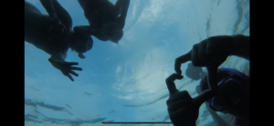
First was the newest Jumanji, and now we are in a thriller! Hopefully tomorrow we will have some good weather for a lovely sunrise and snorkel sesh!!

See yall next time!

Hairy Hill and Freshest Lava on the Island!

Yesterday, we ventured up the saddle road from Hilo toward the island’s center to visit a hairy hill and get a closer look at Mona Kea. The weather was looking questionable on our drive up, and we feared that we would be unable to see the beautiful view from this hairy hill right off the saddle road at the base of Mona Kea. This hill is called a Kipuka. It is a hill in the middle of a black lava desert, whose lush forest starkly contrasts with its barren landscape. Its name is Pu’u Huluhulu, which means hairy hill, which refers to the vegetation still growing from all sides of it. The hill was formed because it became a cinder cone resulting from explosive eruptions of Mauna Kea. Later, when Mauna Loa erupted, the hill escaped the flow and maintained its greenery. For this reason, this place is sacred to native Hawaiians, and as we got out of our vans, we reminded ourselves to be respectful of those who may be in worship or prayer. By some miracle, the dense rain clouds did not follow us to the hill, and we began our small hike in sunny conditions. Once we reached the top, we were in awe of the view’s expansiveness, as we could see three volcanos: Mauna Loa, Mauna Kea, and Kawaihae. Going further up the path, we saw a sacred sculpture of what we believe is the Hawaiian air God.

view from hariy hill of Mauna Kea
Mauna Kea
Our class looking out at Mauna Loa
Looking out at Mauna Loa

Still feeling adventurous, we sought to find the fresh lava that erupted from Mauna Loa in 2022. We had no idea if the observatory road was open, but we took our chances and went up it anyway. Suspecting the flow was at about 9000 ft, we kept climbing up, hoping the road would remain open. We were in luck! Just after 9000 feet, we saw the road overtaken by the 2022 flow, and we got out of the van to explore the view. We noticed the rock was much sharper than other flows we had walked over. The view was fantastic, and it was a unique experience to walk on such a young lava flow, as it was the closest we could get to real lava.

standing on the 2022 lava flow with Mauna Kea in the background
Fresh 2022 flow

Famers Market and Kipuka Pu’u Huluhulu

Today Adien and I woke up at 5:30 to go and see the sunrise. It was not as cloudy as previous days so we could actually see it which was amazing. After this, I went back to my room relaxed, got ready for the day, and we left to head to the Farmers Market in Hilo. This was an incredible place and I tried a lot of different fruits I would not have been able to if I was not in Hawaii. I got this amazing drink that had some pineapple, mango, and some other fruits. I got some awesome, high-quality, handmade shirts. I got one for me and one for both of my brothers. After this, we kept looking around we and saw some cool paintings and jewelry. We got L&L for lunch and then went to the Japanese gardens to eat. We walked around the gardens and then got back in the car and headed off to Kipuka Pu’u Huluhulu. 

Hilo Farmers Market

Becca with a coconut

Kipuka Pu’u Huluhulu is a 38-acre tree sanctuary located in the center of Hawaii. Kipuka means a hill that is surrounded by lava but is spared from flowing lava because of its elevation. Pu’u Huluhulu means “hairy hill” and when hiking up it was apparent as to why it is named this. When looking at the trees you can see Pele’s hair on the tree. The flows lasted from 1843 to 1935. From this spot, we can see three volcanoes: Mauna Loa, Mauna Kea, and Hualalai. We then went to a park and played on the playground. We even got Katie to join us for a bit. Then we headed off to Mauna Loa and drove up the volcano. We got 9000 ft above sea level until the road stopped. From 2022 to 2023 the volcano erupted and cut off some of the roads (fact check). This was one of my favorite parts as the lava was a year old. When you think about this are some of the newest rocks in the world. We climbed up the rocks which were very sharp. We had to be very careful and Aidan took a little tumble but he was okay. He did get impressively scratched up considering he mostly caught himself. We got some great pictures and then drove back to the Airbnb. We finished Descendants and Mauna and then for dinner, we will be having leftovers and getting some nuggets from the store.

Kipuka Pu’u HuluhuluThe new lava flow

New Fruits and Sights!

The Hilo Farmers’ Market was our first stop of the day which filled all my senses with pleasure. The fruits and other foods they had looked amazing, tasted amazing, and smelled amazing. After exploring the food side of the market, my friends and I ventured to the knick-knacks and clothing part of the market. I saw so much talent and passion in each of the artist’s work. I ended up getting a few shirts from a guy who hand prints the designs and some earrings made of pink coral and shells!

fruit stands
Hilo Farmer’s Market Fruit Stands
the farmer's market in Hilo
a photo I took when we got to the farmer’s market!

We found amazing food which consisted of an acai bowl and insane hotdogs!

Hot dogs and Acai bowls
Hotdogs and Acai for lunch!

We hopped into the car and headed up a ton of elevation on Sadlle Road, to get to Kipuka Pu’u Huluhulu, a native tree sanctuary and sacred ground, where we got a beautiful view of Mauna Kea, Mauna Loa, and Hualalai! It is sacred ground because lava never touched it and so it was therefore spared by Pele!

Walking on the sacred hill
Walking on the top of the Sacred Hill

Finally, we took a winding one-way road called Observatory Road over tons of lava to see where a flow from Mauna Loa about a year and a half ago cut off the road. It was an incredible experince to be standing on practically new born lava, while being able to see the volcanoes with no fog or clouds in the way! We even got to see the summit of Mauna Kea and the observatories placed on the summit! Our teachers were in awe and therefore so were we.

Our class standing by where the road was cut off by the lava

Mauna Kea
A clear view of Mauna Kea!

Another amazing day that never ceases to remind me how amazing God is and how incredible the Earth is!

Papakolea, Two Summits, & Kipuka Pu’u Huluhulu

Day 4 we went to Papakolea! Papakolea is a green sand beach, and is one of the four green sand beaches in the entire world. It has the most green sand out of all of the four beaches. The word “papakolea” literally translates to green clover. This beach is a bay, cut in a cinder cone from Mauna Loa, which erupted 50,000 years ago. The high walls and the bay ring are from the cinder cone collapsing. The green in the sand is from the high amount of olivine, and in Hawaii, is known to be Hawaiian diamonds. The sand itself is made of olivine, coral, and lava rock. As the cinder cone erodes, more green sand is produced, meaning eventually, the green sand on this beach will disappear. It is actually illegal to remove sand from this beach. Additionally, those who do, are believed to inherit a curse. In Hawaii, some natives believe in Pele’s curse. Pele’s curse gives bad luck to anyone who removes things, such as sand and shells, from the Hawaiian island.

Overhead view of the green sand beach
On the beach, we completed a variety of activities to attempt to determine where exactly the olivine was coming from the cinder cone. My group determined that the sand itself was ¼-½ mm and was subangular. Additionally, as seen in the photo below, some layers are thicker than others, and darker. My group determined that the darker layers had higher olivine concentrations, and it’s possible that the majority of the olivine comes from these layers.
Me walking down to the beach
Me walking down to the beach (note the layers of rock)

During our adventures here, we also watched some people cliff diving, which was pretty scary. These people would climb up onto the small cliffs of rock, and time their dives to meet with the peaks of waves coming into the beach. We saw one man who seemingly hurt his ankle by timing it poorly. It was quite worrisome! We then left the beach and had a phenomenal Thai dinner, and all went home to crash in bed early from the like 6 mile day in the sun and 4+ hour driving trip.

This morning, we took a drive into Hilo and went to the local farmers market for two hours! I got a few gifts for a few people at home and a beautiful handmade Hawaiian dress. We grabbed some lunch, headed over to a Japanese garden, ate, and talked about our adventures-to-come.

Hilo farmers market
Hilo farmers market
We then took an adventurous drive to the literal center of the main island, between Mauna Loa and Mauna Kea. Wow! Our first stop was Pu’u Huluhulu. The pu’u, or hill, is actually a kipuka, or a vegetated refuge surrounded by lava flows with a diverse landscape of Hawaiian plants and animals. This hill formed from a Mauna Kea eruption between 14,000 and 16,000 years ago. It became kipuka when Mauna Loa erupted 2,000 years ago, and surrounded it with its pahoehoe flows. This is a sacred space to native Hawaiians, in addition to Mauna Kea. Mauna Kea is believed to be sacred due to the native belief of it connecting the lands to the heavens. When we walked up the kipuka, we were educated about how many natives usually have sacred ceremonies there. Although we did not see any natives, we did see a tiki like wood carving with a sign to denote its religious importance to the native people.
Pu’u Huluhulu
Kipuka Pu’u Huluhulu

After this, we took a look up, and saw the peaks of Mauna Kea and Mauna Loa. This was phenomenal. Professor told us how ¾ of the time she has been there, she was not even able to see her hand in front of her face, let alone the peaks of BOTH volcanoes. In early 2023/late 2022, there was also an eruption from Mauna Loa that cut off the road to the original observatories on Mauna Loa. We drove a few miles up that road, to 9,000ft altitude, and stumbled across the lava that cut off the road. We were able to touch and walk on a year and a half old lava! After taking some pictures, admiring the view, and watching the clouds roll in, we headed out. Tonight was a Star Wars night. I will see you all next time!

Mauna Kea Peak
Mauna Kea Peak
Lava rock under a hand lens
Me holding lava rock with the cut off road behind me

5/11: Farmer’s Market and Saddle Road

I woke up this morning to a pleasant surprise: the sky was clearer than usual, making for a pretty beautiful sunrise. After spending some time on the beach and grabbing breakfast, I set out to get some pictures of Mauna Kea, whose summit was completely visible without any clouds to block it. Walking down the shoreline, I got to see the volcano from a few different angles; I ended up wandering through some weeds, but I ultimately made my way back to the beach house.

Mauna Kea, a massive volcanic mountain, looms in the background. Palm trees and the ocean are in the foreground.
Mauna Kea, seen from the beach near Hilo

For the rest of the morning, we ventured into downtown Hilo for the city’s huge Saturday farmers’ market. The farmers’ market was a vibrant place, with local musicians playing in the streets and rows upon rows of vendors. The oceanside market had everything, from fruits and vegetables to arts and crafts. I tried passionfruit juice—or lilikoi juice, in Hawaiian—and also bought some souvenirs for friends back home. After checking out the vendors, I grabbed lunch at L&L Hawaiian Barbecue, a restaurant suggested by a very wise local (Kaden Buss), and ate with the rest of the class at Liliuokalani Park. A Japanese garden in the middle of Hilo, Liluokalani had some cool Asian architecture and an abundance of endangered Nene geese.

A crowded market, with fruit-covered tables and many customers in the aisleways. Two blue umbrellas and some green crates are prominently visible.
Hilo Farmers’ Market

After lunch, we spent the afternoon driving up the Saddle Road, which runs between Mauna Kea and Mauna Loa. At first, it looked like the experience was going to be a dreary one, and heavy rain plagued most of our drive. However, the foul weather cleared away just as we reached our destination: Pu’u Huluhulu, or the “hairy hill.” The hairy hill is a kipuka, or a hill completely surrounded by lava flows. As a result, kipukas like Pu’u Huluhulu are essentially ecological “islands” that protect native species from foreign hazards. We had to be sure to wipe our shoes before entering the site in order to prevent the spread of invasive plants and diseases. The hairy hill is also a sacred location to native Hawaiians; it is seen as a place where the earth meets the sky, and we saw a statue of a Hawaiian sky god at the hill’s summit. The views from Pu’u Huluhulu were spectacular, and I could see three volcanoes (Mauna Loa, Mauna Kea, and Hualalai) from a single point.

Then, on a whim, we decided to try driving up the Mauna Loa Observatory Road, parts of which were covered by a 2022 lava flow. Professor Knapp thought that the road would be completely closed, but we were actually able to make it all the way up to where the lava had covered the road. This allowed us the chance to walk over relatively fresh (two years old) a’a’ lava. It was sharp! When I took a wrong step, I fell and earned some big scratches on my leg. We also got an even better view of the Mauna Kea summit. Since the region where we were is often rainy, I felt very blessed to be able to see such spectacular sights without much interference from the weather.

-Aiden

In the foreground, a field of rocky, gray, solidified lava sits. In the background, Mauna Kea sits in the midst of some clouds and the bright, blue sky.
Mauna Kea, seen from the 2022 lava field on Mauna Loa

May 11: Hilo Farmer’s Market, Japanese Garden, Pu’u Huluhulu, 2022 Flows

Today was a super fun day. I started the morning with a mini CrossFit workout, and then we all headed to the Hilo Farmer’s Market. 

fruit stands
Hilo Farmer’s Market Fruit Stands

While there, Abby and I got Henna Tattoos, which I think will be a fun story later. 

henna on bicep and forearm
Henna!

After that, we got lunch at a Japanese garden, which was pretty. 

Japanese garden bridge
Japanese Garden Bridge

Then, we visited a Pu’u Huluhulu (hairy hill), a land island surrounded by lava. When a volcano erupts, sometimes the lava flows surround certain green areas but don’t cover them, and those leftover areas develop really interestingly. The one we went to was sacred to Hawaiian protectors, so we learned at lunch how to respect the land and space for the people who believe it was sacred. 

After that, we got to go on a sort of surprise trip on the road leading to the observatory on Mauna Loa…we drove all the way up to the point where 2022 lava flows crossed the road. It was really neat to get to see lava flows that erupted that recently!

top of lava flows on mauan loa
Mauna Loa 2022 Flows
Volcanic Rock from Mauna Loa 2022 Flows

Spontaneous Adventures in Hilo

It is day 5 and we had a nice relaxing adventure in Hilo! 

We traveled to the Hilo’s farmer’s market that they have every Saturday. Here we got to see part of the Hawaiian culture. We got to taste some tasty fruit including papaya, rambutan, lychee, and coconut! They also had amazing art and jewelry. It was so nice to talk to the locals. 

Hilo Farmer's MarketHG, Kaden, and me eating rambutan me drinking a coconut

By Kaden’s suggestion, some of us tried some Hawaiian barbecue at L&L, a Hawaiian restaurant chain. If you ever go there, I highly recommend getting the mini plates over the regular plates because everyone has leftovers. 

Having very full stomachs we traveled up the saddle road which is the fastest way across the island. We stopped at Kipuka Pu’u Huluhulu and we were lucky enough that we had such a clear view. Kipuka Pu’u Huluhulu is a cinder cone called the hairy hill and a sacred place for many Hawaiians. It is surrounded by 1843 and 1935 lava flows. In the years Professor Knapp came to Hawaii, this was the clearest view she had seen. I was surprised how windy it was. You can see how much our hair was blowing in the picture below. We were able to see Mauna Kea, Moana Loa, and Hualālai from Kipuka Pu’u Huluhulu. There were also a lot of wild mountain goats and sheep! 

Kipuka Pu’u Huluhulu and the view of Mauna Kea

Group photo on Kipuka Pu’u Huluhulu


The best part of the day was driving up to 9,000 ft to see the 2022 and 2023 Mauna Loa lava flows. Look at these amazing A’a flows! Fun fact these flows block the road including access to the Mauna Loa NOAA observatories.

2022/2023 A'a flows
The group on the lava flows that blocked the road

-Becca Goldman 

Hilo Farmer’s Market – so many new foods!

Mom and Dad – if you’re reading this, you should be so proud of me!

I’m normally an incredibly picky eater, but on this trip I’m making an effort to try as many new foods as I can, and today was quite a demonstration of that! We went to the Hilo Farmer’s Market, and it was so neat to walk around and see not only all of the different fruits and vegetables that we can’t get back home, but also all of the different things that local artists have made. I walked around for a while with Grace and Margot and ended up buying a shirt that was hand printed from a carved block of vinyl – so cool! – as well as a pound each of rambutan and longan to try. I didn’t love the longan, but I did really like the rambutan!

a blue shirt with a printed screen on it
The shirt I got at the farmer’s market!

Afterwards, several of us walked over to the L&L nearby. Kaden said it was his favorite Hawaiian “fast food”, so of course we had to try it! While we were waiting for our food, I had the chance to try coconut water, and while I didn’t love it, it wasn’t bad. I got a barbecue chicken plate, which came with barbecue chicken, rice, and macaroni salad, and they were all very good. I had never had macaroni salad before, but I didn’t hate it!

When we got back to the airbnb this evening, I was also able to try a lychee and “ice cream bean”. The lychee was alright – not as good as the rambutan but better than the longan – but I did not like the ice cream bean. All in all, I thoroughly enjoyed these opportunities to try new foods and experience more of the Hawaiian culture!

– Caroline

the farmer's market in Hilo
a photo I took when we got to the farmer’s market!

Chain of Craters, Trollis, and Snorkeling!

Hey blog readers!

I lived my Moana dream life today. I woke up going snorkeling, I ended my day snorkeling, and I got some sun (a little too much sun). I also learned that you are 15 times more likely to die from falling coconuts than shark attacks according to Kaden.

Me, Abby, and Katie snorkeling


As we traveled to Volcano National Park to start our day we stopped at a gas station cleaning out their entire inventory of Trolli eggs (our new favorite road trip and lunch snack)!


We began driving down the chain of craters. This is along the southeast rift zone of Kilauea. It is an 18.8-mile drive from the summit to the Holei sea arch. We started with the Puhimau crater. These craters are formed through collapses caused by draining lava. This crater is 200-600 years old. Sometimes craters will fill back with lava, but this Puhimau Crater remains a spectacular hole for many visitors. 

Map of Chain of Craters road
Puhimau Crater

Puhimau Crater


We then continued to Devil’s Throat! This is a secret crater that regular visitors know of. It was discovered by a US geologist, James Jagger, in 1912. Back then it was only 20 m wide. Now it is about 150 m wide and 165 m deep. We were very careful in staying far enough back not to fall in. Here we could see the intertwined a’a and pahoehoe flows. The redder spots are the iron-enriched a’a flows. 

Devil's Throat
Devil’s Throat

We traveled down the road to Mauna Ulu which erupted from 1969-1974. Lava flows closed part of the Chain of Craters road when it erupted. We got to see some cool iron oxides in the lava field!

a cool iron oxide

Jake, Mac, Abby, and others

As continued to the coast we can see the distinction between the crackly A’A flows and the smooth Pahoehoe lava flows. We also took a short hike to see some Hawaiian petroglyphs. The circle markings are where the Hawaiians have offered the umbilical cords of their children. 

Picture of both A'a and Pahoehoe lava flows

Petroglyphs on lava

We finished at the Holei sea arch which is formed through erosion. It won’t be here forever because the waves will erode it. This was one of my favorite views so far on the trip. The ocean was so beautiful!

When we got back Abby, Katie, and I tried to take some cool photos snorkeling but failed. Here are some photos with Abby’s go-pro. 

Me snorkeling

Becca Goldman