So I planned to write this blog today but we had a change of plans since our van couldn’t make it down the road to the beach because of some rocks and holes.
So now all reflect on Wednesday!!
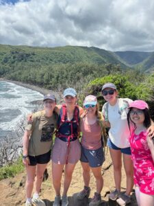
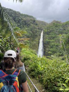
We traveled forever to get to Pololu Valley. It was definitely worth the drive. It was such a beautiful view from the overlook. However, the hike was super steep and coming up was a struggle. All of at least got our cardio in!
HG, Lucy, Abby, Van, and me hiking down the Pololu Valley
This valley is one of seven valleys of the kings. King Kamehameha has hid in this valley until of age for some would hunt him as a babe. These beautiful valleys were formed through erosion. Located on Kohala, there are more alkalotic material. We can see lighter rocks such as sodium feldspar. The sand was also super fine due to erosion and weathering. We even got to see sand dunes. These dunes are where some Hawaiian bones are buried.
After Pololū Valley and eating lunch we tried to go to a beach on the way back but it was closed due to debris in the water. So we went straight to see some xenoliths!
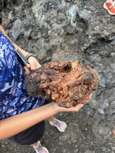
A xenolith is a rock trapped within another rock. These specific ones are large olivine that were trapped in magma from 1800 lava flows.
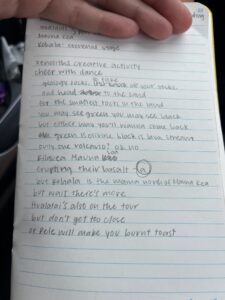
Lil Volcano (or band) featuring Caroline, Grace, Margot, HG, and I made an amazing rap about the Hawaiian volcanoes for our recap assignment here. Below are the lyrics…. Drop the beat.
Tuesday was our first full day in Kona. Some of us woke up in the early morning to go to a beach that Kaden regularly visits. It was a black sand beach and the water was so crystal clear. It was a great spot for snorkeling and we tried our hand at paddle boarding. It was very hard to stand on the board with the waves, but we all were able to stand for at least a few seconds!
We met the other group at Pu’uhonua o Honaunau. This is a place of refuge originally built in 1650. Hawaii was divided into districts. Kapu were there rules or regulations that Hawaiians needed to follow. For example, women could not eat sacred fruits such as bananas and couldn’t eat in front of men. Men couldn’t look the chief in the eye or walk in his shadow. If the kapu were broken, they were executed.
The alternative is to flee to one of these places of refuge. This was a safe haven for exiles. They ask for a priest for forgiveness and they enter into the program. Today it is a national historical park. Many native Hawaiians still use Pu’uhonua o Honaunau as a sacred site and site of ceremonies/rituals.
After eating lunch and trying the avocado from Kaden’s house we headed to Two Step. This is a popular spot for snorkeling. There were lots of urchins and cool fish. We got to see a ginormous parrot fish!
Next, we took a quick stop at Captain Cook’s reserve. In 1789, Captain Cook was the first explorer to find Hawaii. This was the site of where he landed but also the site of where he died. At first, the native Hawaiians greeted him with kindness because they thought he was a god due to his white complexion. Cook left but damaged the ship’s mast so he returned. The Hawaiians knew that he wasn’t a god and Cook and his crew got aggressive with the Hawaiians. He was killed and now there is a monument in the reserve.
It was a long day in the sun and being the analytical thinkers we are, we applied layers of sunscreen throughout the day. Very few of us were burnt! (Except for Mac whose whole back was burnt). Overall it was a very fun day!
I woke up and finally tried the Hawaiian dish… SPAM! I actually found it delicious. So thank you Kaden for insisting everyone to try some even if Mac didn’t.
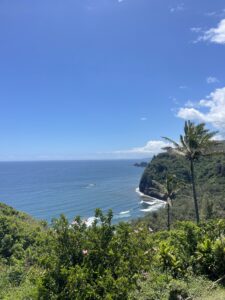
We sadly had to move out of our air B and B. We had amazing time there in Hilo, but we had to move up north along the Hamakua Coast, to Kohala volcano and back around to Kona.
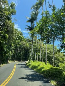
Drive on Hamakua coast
As we drove through up north, this side of the island is older and it the most fertile and lush area on the island. In the 19th and 20th century, it was covered in sugar cane. Today there is still lots of smaller farmers in the area. It such amazing vegetation and rivers as well. We stopped to look at a hot tourist destination, Akaka Falls. This gorgeous waterfall plunges 442 feet into a stream-eroded gorge. Read the Hawaiian legend of the formation of Akaka Falls below.
Akaka Falls
“The legend of Akaka Falls is quite interesting. In the olden days, there was a warrior chief named ‘Akaka in the village of Honomu. Strong and very handsome, he was famed throughout the island and attracted the eyes of the ladies. One day, while his faithful and trusting wife was visiting her parents in the distant village of Hilo, ‘Akaka went to see his sweetheart on the north side of the gulch. Her name was Lehua. Seeing his wife return unexpectedly, he left Lehua’s hut by the back door and crossed the gulch to visit his other sweetheart, Maile, who lived on the south side. Following him there because of the scented grass he wore, his wife called for him to return home. Hearing her call him, ‘Akaka hastily sped out the back door and took a shortcut to his home.
Alone at last, ‘Akaka contemplated his ill behavior as he sat in the hut with his loyal dog. Overwhelmed with shame that he could deceive his loving wife, ‘Akaka fled the hut with his dog following closely at his heels. ‘Akaka approached a projecting rock on the top of a bluff. Looking down to the sea, he then threw himself over the cliff and fell headlong to the far valley below, transformed into the waterfall.
His dog hesitated and was turned immediately into a jagged rock at the top of the falls. His wife, following ‘Akaka closely, rushed through the brush to get to his side. She began to call him, but it was too late. His wife rushed to the edge, and overcome with grief, wept uncontrollably and called for ‘Akaka. It was then that she was transformed into a large rock at the top of the falls. As she wished, she is now permanently there next to ‘Akaka.
The heartbroken sweethearts, Maile and Lehua, upon hearing of ‘Akaka’s death, cried and cried until they too were turned into waterfalls, a little further down the gulch from Akaka Falls. According to Legend of Akaka Falls, this was how the falls came about. Old timers say that on a still and moonless night, when the leaves are quiet and the crickets silent, one can hear, nearly muffled by the roar of the falls, his wife still calling for ‘Akaka.”’
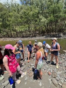
Katie told us the geology behind rivers with her fluvial morphology knowledge. She said this was a knickpoint, which is a break in the river. Three factors could have created it.
Faulting motion through plate tectonic activity
Lithology: considering the type of rocks and there erosion factors
Climate: base line fluctuations and changes in the lowest elevation river levels
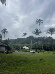
We took another drive to Laupahoehoe, the site of a massive 56 ft tsunami in 1946. It stemmed from an earthquake in the Alaskan islands. We learned how important warning systems are, for there weren’t any back then.
Laupahoehoe park
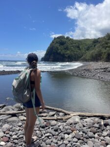
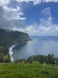
We had a final stop in Waipio Valley. This area is more advanced in its erosional stages, which can be seen in its broader valleys. The abrupt cliffs are likely formed from landslides. It’s part of Kohala and named the Valley of the Kings. It was once home to King Kamehameha. His bones actually lie in caves along the cliff side. This has been my favorite area of the island and I can’t wait to return to Kohala to see more of the landscape.
It is day 5 and we had a nice relaxing adventure in Hilo!
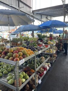
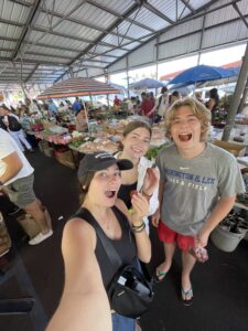
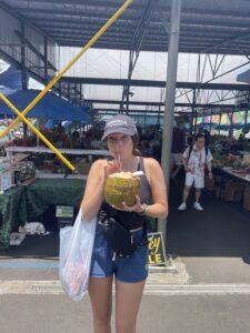
We traveled to the Hilo’s farmer’s market that they have every Saturday. Here we got to see part of the Hawaiian culture. We got to taste some tasty fruit including papaya, rambutan, lychee, and coconut! They also had amazing art and jewelry. It was so nice to talk to the locals.
By Kaden’s suggestion, some of us tried some Hawaiian barbecue at L&L, a Hawaiian restaurant chain. If you ever go there, I highly recommend getting the mini plates over the regular plates because everyone has leftovers.
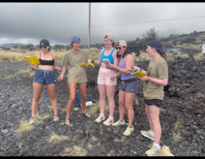
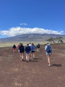
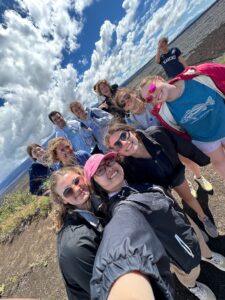
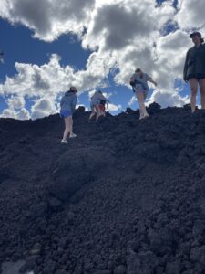
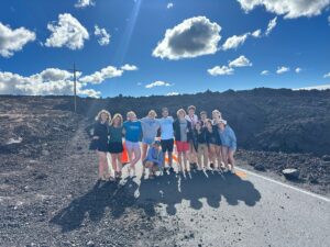
Having very full stomachs we traveled up the saddle road which is the fastest way across the island. We stopped at Kipuka Pu’u Huluhulu and we were lucky enough that we had such a clear view. Kipuka Pu’u Huluhulu is a cinder cone called the hairy hill and a sacred place for many Hawaiians. It is surrounded by 1843 and 1935 lava flows. In the years Professor Knapp came to Hawaii, this was the clearest view she had seen. I was surprised how windy it was. You can see how much our hair was blowing in the picture below. We were able to see Mauna Kea, Moana Loa, and Hualālai from Kipuka Pu’u Huluhulu. There were also a lot of wild mountain goats and sheep!
Kipuka Pu’u Huluhulu and the view of Mauna Kea
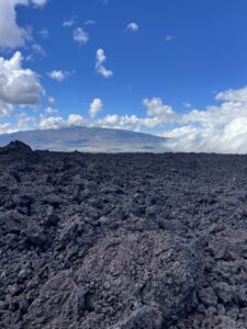
The best part of the day was driving up to 9,000 ft to see the 2022 and 2023 Mauna Loa lava flows. Look at these amazing A’a flows! Fun fact these flows block the road including access to the Mauna Loa NOAA observatories.
I lived my Moana dream life today. I woke up going snorkeling, I ended my day snorkeling, and I got some sun (a little too much sun). I also learned that you are 15 times more likely to die from falling coconuts than shark attacks according to Kaden.
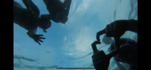
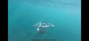
Me, Abby, and Katie snorkeling
As we traveled to Volcano National Park to start our day we stopped at a gas station cleaning out their entire inventory of Trolli eggs (our new favorite road trip and lunch snack)!
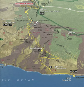
We began driving down the chain of craters. This is along the southeast rift zone of Kilauea. It is an 18.8-mile drive from the summit to the Holei sea arch. We started with the Puhimau crater. These craters are formed through collapses caused by draining lava. This crater is 200-600 years old. Sometimes craters will fill back with lava, but this Puhimau Crater remains a spectacular hole for many visitors.
Puhimau Crater
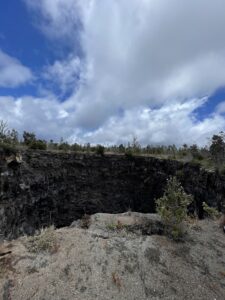
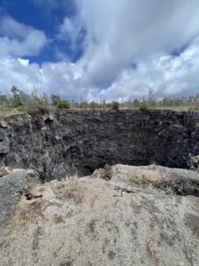
We then continued to Devil’s Throat! This is a secret crater that regular visitors know of. It was discovered by a US geologist, James Jagger, in 1912. Back then it was only 20 m wide. Now it is about 150 m wide and 165 m deep. We were very careful in staying far enough back not to fall in. Here we could see the intertwined a’a and pahoehoe flows. The redder spots are the iron-enriched a’a flows.
Devil’s Throat
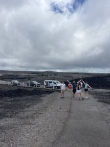
We traveled down the road to Mauna Ulu which erupted from 1969-1974. Lava flows closed part of the Chain of Craters road when it erupted. We got to see some cool iron oxides in the lava field!
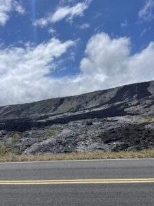
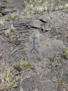
As continued to the coast we can see the distinction between the crackly A’A flows and the smooth Pahoehoe lava flows. We also took a short hike to see some Hawaiian petroglyphs. The circle markings are where the Hawaiians have offered the umbilical cords of their children.
We finished at the Holei sea arch which is formed through erosion. It won’t be here forever because the waves will erode it. This was one of my favorite views so far on the trip. The ocean was so beautiful!
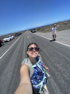
When we got back Abby, Katie, and I tried to take some cool photos snorkeling but failed. Here are some photos with Abby’s go-pro.