Lava Trees, Fissure 8, & Pohoikis!

I started off my day this morning at 7:00AM, and went to church at 8! Church was great to attend this morning, especially in Hawaii and on Mothers Day. It was really interesting to see the Hawaiian culture to be even in religious areas! Some of the service was in Hawaiian which was super interesting.
I went back and called my parents, and wished my Mom a happy Mothers Day! Everyone. If you are reading this on Mothers Day, stop right now and wish a Mom in your life a happy day!

Cute "just smile" sign this morning
Cute “just smile” sign this morning


A church
Church!

After this, we loaded up the vans to go to visit the lava trees. The lava trees and the lava tree molds were formed after the 1790 Kilauea eruption. The trees are filled with lots of water. When lava surrounds them, the water evaporates, and as the tree cools, it insulates itself from the lava, encasing it and forming a lava tree. To form a lava tree mold, which is in the ground, the tree actually catches fire and fully burns. Sometimes, in lava tree molds, the texture of the bark can be seen! The lava trees and the lava tree molds have a large geological importance, as they can show the direction of the lava flow, the date of the eruption, and more important information!
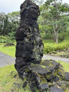
lava tree
Lava Tree
lava tree mold
Lava tree mold

After this, we visited a local couple who lives by fissure 8. Yesterday at the farmers market, Professor Knapp was looking at an art gallery and met one of the artists who lives by that fissure and she invited us to see the fissure and her house, and to have a pizza party with them!
They had a beautiful house, full of Nicole’s artwork.
Before the LOVELY and DELICIOUS pizza party, we went to the edge of the lava by the cinder cone created by the 2018 kilauea eruption. 700 homes were taken and destroyed by this eruption, but there were 0 deaths. Fissure 8 was the most destructive out of all of the fissures. Unfortunately, there is no lava insurance for Hawaii, so the people who lost their homes, lost everything. At the edge of the lava flow, we saw “kapu” etched into the lava that bordered a burnt fence on the outer edge of a burnt driveway. “Kapu” translates to “no trespassing” or “forbidden”. We did not go further into this lava flow, as it would be quite inappropriate considering underneath it lay people’s entire homes and belongings. Sadly, the homeowners now own parts of that cinder cone.

Lava flows cutting off a road, and covering houses
Kapu written in rock at the edge of a ruined driveway

After listening to the eruption stories from the kind couple that welcomed us, we said our goodbyes and headed toward Kaimu, which is a beach by Kalpana. Kaimu literally means gathering at the sea. It was a large lava flow that was formed in 1990 from the Kilauea lava flows. It buried most of the original black sand beach. The black of the sand is from the volcanic basalts. Today, we did not see any black sand since the tide was in, but usually you can see it. The place is a symbol of regrowth and return with the immense vegetation regrowth after the lava flows. The surrounding community cleared up these lava flows and labeled some plants for non-natives, after some groups graffitied and took over the lava rocks.

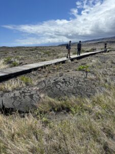
Walkway toward the Kaimu beach
Cultural paintings on the lava rocks by the beach

We then headed to Isaac Harbor and the pohoiki’s that surround it. Isaac Harbor was the primary working boat harbor to its surrounding community, and was taken over by lava in 2018. The lava entering the water creates some glassy basalt and laze (gaseous HCl). This glassy basalt now created the largest and most new black sand beach in Hawaii.

The old harbor, with a hot spring in the background

Here is some background information that I lectured on before I dive into Puna Hot Springs…

Puna is known to be Pele’s workshop, where the volcano goddess continually creates and recreates land. Puna is the area from kilauea’s summit east to the sea, and is where the hot springs are!

Now…
Pohoiki in Hawaiian literally means small hole, fitting due to the size of the spring. Most of the hot springs existed before the 2018 eruption, which created the biggest black sand beach on the island as I’ve previously mentioned. The lava flow from this eruption also formed surrounding springs that are larger but with less consistent temperatures.

The pool was formed in a collapsed lava tube. The groundwater is heated by volcanic activity in the eastern rift zone of the Kilauea volcano. The pools are filled with rainwater that is heated to around 100 degrees and as it flows above the lava underground and mixes with cool sea water, the water temperature is around 98 degrees. The smaller pohoiki is about 4 feet deep. This spring also has hundreds of red shrimp, called ʻōpaeʻula,. It is said that they surround the warmer part of spring, and they sometimes move over peoples skin! Unfortunately, these hot springs typically are areas characterized by low oxygen levels, low light levels and high concentrations of sulfur and calcium carbonate, so they have adapted microbes/bacteria. Due to this, the EPA and the state suggest not entering if there are any open cuts or sores. And if entering, then do not dunk your head or get water in your mouth, and shower after.

That’s all the information I lectured about today at the Pohoiki!

We then went home, and are currently binging some movies! Last night in Hilo 🙁
First was the newest Jumanji, and now we are in a thriller! Hopefully tomorrow we will have some good weather for a lovely sunrise and snorkel sesh!!

See yall next time!

Papakolea, Two Summits, & Kipuka Pu’u Huluhulu

Day 4 we went to Papakolea! Papakolea is a green sand beach, and is one of the four green sand beaches in the entire world. It has the most green sand out of all of the four beaches. The word “papakolea” literally translates to green clover. This beach is a bay, cut in a cinder cone from Mauna Loa, which erupted 50,000 years ago. The high walls and the bay ring are from the cinder cone collapsing. The green in the sand is from the high amount of olivine, and in Hawaii, is known to be Hawaiian diamonds. The sand itself is made of olivine, coral, and lava rock. As the cinder cone erodes, more green sand is produced, meaning eventually, the green sand on this beach will disappear. It is actually illegal to remove sand from this beach. Additionally, those who do, are believed to inherit a curse. In Hawaii, some natives believe in Pele’s curse. Pele’s curse gives bad luck to anyone who removes things, such as sand and shells, from the Hawaiian island.

Overhead view of the green sand beach
On the beach, we completed a variety of activities to attempt to determine where exactly the olivine was coming from the cinder cone. My group determined that the sand itself was ¼-½ mm and was subangular. Additionally, as seen in the photo below, some layers are thicker than others, and darker. My group determined that the darker layers had higher olivine concentrations, and it’s possible that the majority of the olivine comes from these layers.
Me walking down to the beach
Me walking down to the beach (note the layers of rock)

During our adventures here, we also watched some people cliff diving, which was pretty scary. These people would climb up onto the small cliffs of rock, and time their dives to meet with the peaks of waves coming into the beach. We saw one man who seemingly hurt his ankle by timing it poorly. It was quite worrisome! We then left the beach and had a phenomenal Thai dinner, and all went home to crash in bed early from the like 6 mile day in the sun and 4+ hour driving trip.

This morning, we took a drive into Hilo and went to the local farmers market for two hours! I got a few gifts for a few people at home and a beautiful handmade Hawaiian dress. We grabbed some lunch, headed over to a Japanese garden, ate, and talked about our adventures-to-come.

Hilo farmers market
Hilo farmers market
We then took an adventurous drive to the literal center of the main island, between Mauna Loa and Mauna Kea. Wow! Our first stop was Pu’u Huluhulu. The pu’u, or hill, is actually a kipuka, or a vegetated refuge surrounded by lava flows with a diverse landscape of Hawaiian plants and animals. This hill formed from a Mauna Kea eruption between 14,000 and 16,000 years ago. It became kipuka when Mauna Loa erupted 2,000 years ago, and surrounded it with its pahoehoe flows. This is a sacred space to native Hawaiians, in addition to Mauna Kea. Mauna Kea is believed to be sacred due to the native belief of it connecting the lands to the heavens. When we walked up the kipuka, we were educated about how many natives usually have sacred ceremonies there. Although we did not see any natives, we did see a tiki like wood carving with a sign to denote its religious importance to the native people.
Pu’u Huluhulu
Kipuka Pu’u Huluhulu

After this, we took a look up, and saw the peaks of Mauna Kea and Mauna Loa. This was phenomenal. Professor told us how ¾ of the time she has been there, she was not even able to see her hand in front of her face, let alone the peaks of BOTH volcanoes. In early 2023/late 2022, there was also an eruption from Mauna Loa that cut off the road to the original observatories on Mauna Loa. We drove a few miles up that road, to 9,000ft altitude, and stumbled across the lava that cut off the road. We were able to touch and walk on a year and a half old lava! After taking some pictures, admiring the view, and watching the clouds roll in, we headed out. Tonight was a Star Wars night. I will see you all next time!

Mauna Kea Peak
Mauna Kea Peak
Lava rock under a hand lens
Me holding lava rock with the cut off road behind me

Day 3: Pit Craters, Lava Rock, Petroglyphs, and a Birthday!

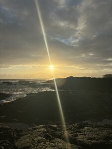
Once again, I started off my morning very early: at 5:30. I watched the beautiful sunrise with Lucy! Then afterward, continued with my habitual snorkeling session in the morning.

morning sunrise
Morning Sunrise

We took our first stop at the chain of craters, specifically the Puhimau Crater. This is a pit crater along the south east rift zone of the shield volcano Kīlauea. Pit craters form from when lava drains, and the ground collapses in on itself. This pit crater features erosional collapse features since it never refilled with lava. It is around 200-600 years old, and has mostly pahoehoe flows. The name Puhimau means forever smoking, which can be seen through the steam around the top of the crater.

Puhimau Crater
Puhimau Crater
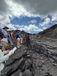
Our second stop was the classic secret Devils Throat pit crater. Geoscientists believe this to be the epitome of all pit craters. It was discovered in 1912 by Thomas Jaegar. It is 165m deep. Originally, it was 20m wide, but expanded to 150m now. This pit crater is off trail, and is quite hidden.  The distinctive cross sections of this pit crater illustrate how intertwined the two types of lava flow can be. In the image below, the red chunky rock are the a a flows, while the blocky rocks are the pahoehoe flows.
Differing Lava Flows in Devils Throat

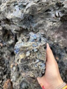
We made another stop at a lava field, and saw some vesicular lava rock. This rock was very shiny with multicolor/iridescence, and was surprisingly light when picking it up! While walking back, we met a local who showed us some local tropical fruit and this beautiful shell necklace he made 20 years ago. The local (well sort of local, he’s actually from Minnesota), suggested places we travel, but they were already on the list!

Tim's Necklace
The Shell Necklace
Iridescent Minerals
Iridescent Minerals
Iridescent Rock
Iridescent Rock
Vesicular rock
Vesicular rock

Something that really amazes me about Hawaii is that the horizon is literally the ocean! How cool!

Stopping for lunch we were able to see the lava travel all the way to the ocean, and once again, the two types of lava. It was phenomenal. Look at the pictures below! We were able to see the pali too, which are cliffs in Hawaiian! The tension from the caldera causes the large blocks to drop off, creating landslides and the cliffs. There are two motions types with pali. The quick motion creates tsunamis, but there are also the creep, which are the slow, constant movements along the normal faults. Later, driving down, we could again really see the difference in the two lava flows!

The Two Different Lava Flows

We then visited the Pu’uloa petroglyphs. Hawaiian natives utilized sharp tools to create impressions in the lava surface. Each circle represents an umbilical cord in these petroglyphs. There are a variety of petroglyphs here of people, animals, canoes, and more. 16,000 of the 23,000 were made to put umbilical cords in. This offering was made to the mountain goddess in honor of one’s child, asking her to give them a long life and to connect them to their ancestors and the land.

The Pu’uloa Petroglyphs

After that slightly hot hike, we then drove to the sea arch by the Holei Pali and saw the bluest blue ocean I have ever seen in my entire life. It was jaw dropping. Driving with the windows down looking at the waves crashing up the cliffs and the deep blue was unforgettable. Sea arches start as a sea cliff, from where the lava meets the sea. Once the lava cools, it erodes, and the wind and water fracture the cliffs into sea caves. Then the waves erode it into sea arches. Unfortunately, this famous arch won’t be here forever. After enough time, the waves will erode the arch and create a column of rocks.

Holei Pali (Cliffs)
Holei Pali (Cliffs)
The sea arch
Sea Arch

We ended our day jamming out to music on the way back to the Airbnb, grilling up some burgers and making Lucy’s famous Mac and cheese, decorating an awesome shark birthday cake for Van, getting some flicks while snorkeling, and then watching a movie! I’m writing this before the movie activities, but hopefully we will watch Journey to the Center of the Earth! See you all next time!
Vans birthday cake with blue sharks
Van’s Birthday Cake!

Fun PSA… I overcame my fear of the ocean! Kaden told us how we are 30x more likely to die from a coconut falling on us rather than a shark attack, so I ended my day with an hour or two in the water hanging on some kayaks, snorkeling around, and getting some good shots on my GoPro.

Ka wāwae wāwae

Two days ago was our first full day in Hawaii, and it was quite eventful! 

Our very first stop was at Kadens Uncles property to learn more about Hawaiian culture, and farming. Coffee farming is slowly taking over the macedonia nut farming in Hawaii, and is becoming more and more profitable. I learned about Kona coffee for the first time! 51% of it now has to be from Kona to be dubbed the term, “Kona coffee”. After this, we went over to Kadens farm, and had some absolutely delicious banana bread (that I will never forget). We foraged around for some fruit and veggies, talked with Kadens Mom, pet his dog, and went to our very first geo stop. We also learned that until around 30 years ago, it was illegal to teach the language of Hawaiin to non-natives. 

Dog laying on deck
Kadens dog Blitz laying on his deck


Kaden knocking down an avocado


Caroline holding a fruit at Kadens farm

The first stop was in the Punalu’u harbor (close to Ocean View town) to look at the gorgeous black sand beach. On the way to the harbor, we saw the drastic change of landscape that the lava flows would cause. They truly do cut through foliage like a knife! 

Punalu’u literally means, “diving for springs”. We learned earlier in the day that the majority of this side of the islands water come from the rain. Diving for springs is referencing how a lot of the fresh rainwater comes into the salt water. 

Black sand beach
The beach

The majority of the volcanic rock here was from the Mauna Loa flows, and is 3,000-5,000 years old. There are a variety of littoral cones in this area, which are cones that erupt near the water. Additionally, the sand here is quite complex. It is made from a variety of materials, such as: hawaiian coral and shells, weathered lava, lava glass, basalts, and olivine. The material is either from submarine or subaerial sources. 

After this, we broke into groups to determine how many grains of sand were on that beach. Utilizing the data we collected on campus (regarding how many meters each one of our strides are), we measured the length and width of the beach, as well as the depth of the sand, and our group estimated that there were 10 trillion grains of sand! 

Van looking at the depth of the beach

We then departed for our “footprints hike”. To clarify the title, Ka wāwae wāwae means footprints. The Ka’u has a desert-like appearance due to the acid rain from Mauna Loa. The Mauna Loa flows mainly contribute to the volcanic rock in this hike. The a’a flows (more crunchy and chunky flows) and the pahoehoe flows (more smooth) were very obvious on this hike, which was very interesting! The volcanic ash also spread across the entire surface. 

The class surrounding an enclosure of the footprints

There are a few stories behind this footprint hike. But, the main one stems from a battle regarding the heir after the king of Hawaii died. During a battle, it was thought that Kilauea erupted, covering the three battle groups. The footprints in the rock were thought to be theirs. Recently though, the prints were found to be not from warriors, but mostly women and children, and additionally were dated to be before the thought date of the battle. 

Until next time! We are currently all typing up our blogs and eating some delicious chocolate chips that Mac is making!
Day Two: Lava Lakes, Lava Tubes, & Turtles!

Today was the second day in Hawaii, and it definitely was jam packed!

I started off by waking up bright and early at 5:50 in the morning! I walked down to the beach and watched the last part of the sunset, just to see the sun peeking up and a small rainbow forming. Afterwards, I grabbed the snorkel gear and swam around for a while! Although the coral isn’t the brightest, the bright yellow and striped fish definitely made up for it.

Turtle swimming in clear water
Sea turtle in a tidepool!
Bright Hawaii sun rising above the water and rocks
Gorgeous Hawaii sunrise

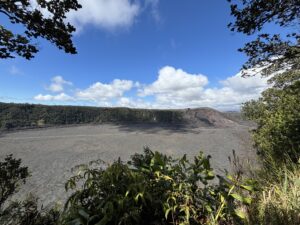
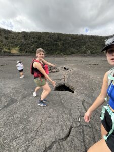
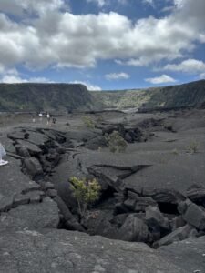
We eventually made our way back to our Airbnb (which is pretty awesome by the way), and we made some breakfast, hopped in the car, and went to our first stop of the day: Kilauea Iki Lava Lake! We took a decently long hike down to the bottom of the dried up lava lake, listening to Professor Knapps debriefs of around 12 stops. At the bottom, we had the privilege of looking at the lava rock below, and learning about how during the eruption, this lava lake spewed incredibly high in the air, way above the highest landmark in the area, around 580m! The eruption in 1959 was incredibly huge. For scale, 580m tall is as tall as the World Trade Center was. The most recent eruption was not as large, and was in 2018, but the left over water in 2019 proved to be a large concern, as the water increased the possibility for a more explosive eruption.

The deep fissure in the bottom of the lava lake
Varying thickness of the lava rocks!
The class around the same deep fissure
Deep fissure in the lava lake
A picture from the top of the lava lake, of the cavity of black rock and blue sky above
Image from the top of the lava lake

Many natives believe that the volcanic deity, Pele, made this her most spectacular display. The Kilauea calder is known to be the home of this volcano goddess.

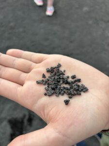
Something that was quite interesting was the variety of rock textures below. Although it was all mostly lava rock, due to weathering, and the lava lake drying, there were many different textures present. Weathering from acidic rain (mainly sulfuric acid), rain and wind, and people, caused some of the rock to break up into sand appearing parts. Picking up the sandy parts, one would find tiny rocks, with a texture differing that of a normal beach. Additionally, when looking at the main fissure in the ground, the thickness of the lava rock became quite prevalent to us. When looking at the below pictures, it looks just rocky. But moving across, you can see the true thickness of this rock.

Interesting rock texture at the bottom of the lava lake
Odd texture of lava rock in the lava lake

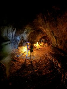
After this, we made our way back up out of the lava lake, and made our way to the Thurston Lava Tube, which was incredible, and very dark as you can see below! Lava tubes are general passageways that lava travels through, usually under a lava flow. Some are small, like the one Lucy is pointing to in the lava lake, while others are huge! When lava empties from them though, they leave a huge cave! The cave today was pretty dark and moist. After this, we spent some time looking at the caldera of Kilauea, seeing the steam still rising from the floor of it.

Dark tunnel in a lava tube
HUGE lava tube
Lucy pointing to a lava tube in the ground on the lava lake
Mini lava tube in the lava lake

We then left and checked out the volcanos museum and gift store, as well as the art. It is really interesting to look at how prevalent Hawaiian culture is within their art. It is breathtaking.

After this, we took our last volcanic trip of the day to the sulfur banks. When the summit of Kilauea collapsed due to the loss of magma, the caldera was formed. The volcanic gasses under the caldera, ranging from sulfur to other gasses, are then released as steam! The yellow color in the image below is also from the sulfur.

Picture of the sulfur steam!
Sulfur Vents

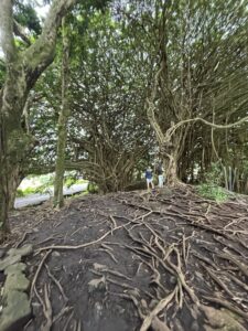
Going back to the AirBnB in Hilo, we stopped at our first natural stream, and took a peak at what it feeds into: the rainbow waterfall! This was breathtaking, as well as the tree that surrounded it! As seen below, its roots and branches branch everywhere!

Very cool tree in Hilo, with a lot of very spaghetti string appearing branches, and roots going everywhere.
Funky tree!

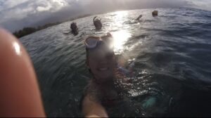
Getting home, we took another snorkeling trip (as seen below), found some more sea turtles, started on our spaghetti dinner, watched some Teen Beach Movie, and called it a night.

Selfie of the students in the water.
Selfie!

Another our next adventures tomorrow! Stay tuned!